GET IN TOUCH

YelloSKYE maps

High-Resolution GIS Maps for Data-driven Insights

Companies flying with us

YelloSKYE Maps, where we bring you cutting-edge geospatial solutions that redefine the way you visualise and analyse data. Our high-resolution, GIS compliant maps cater to large-scale projects, providing a top-notch level of clarity, analysis, and accurate insights.
With our data consumption capabilities, you can collect data at scale, create interactive layers, and collaborate seamlessly through our cloud-based platform. Interact with multiple layers of data, from simple to complex custom features, to uncover hidden patterns and make informed decisions. Our easy shareability ensures that you can export and share data in industry-standard GIS formats, facilitating collaboration across platforms and stakeholders. Experience our solution-oriented approach, where we empower you with the tools to unlock the full potential of your data and achieve better outcomes.

Key Use Cases

Welcome to YelloSKYE Maps! Discover the power of accurate geospatial data for your business decisions. Access valuable insights through our interactive platform and make informed choices with location-based intelligence.

Digital Surface Models (DSM) of your Asset

Digital Terrain Models (DTM) of your Asset

Accurate and measurable Orthomosaic Maps

Contour maps for 2D visualization

Planimetric Maps of Your Asset

Unlimited Image Processing

Point regarding capability of the size of the survey land

CAD Overlay for Plan vs Reality Checks

Compare CAD drawings with actual drone images for accurate assessments. Identify deviations, alignments, and discrepancies to improve decision-making and quality control.

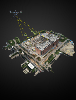
Accurate 2D and 3D Digital Twins

Experience precise digital replicas of your assets created from high-quality drone-captured images. These digital twins can be used for design, analysis, simulations, and more. Accessible through our cloud platform, they are available anytime, anywhere.

Powerful Measuring Capabilities

Measure distances between any two points, calculate areas or volumes, determine the elevation of specific locations, and generate profiles effortlessly. Our platform provides a comprehensive suite of measuring tools, empowering you to extract precise and meaningful data.

Integration with Legacy Systems and Software

Effortlessly integrate with your existing software such as Autodesk Revit, ArcGIS, and more. Export data in compatible formats for a smooth transition.

Ignite Your Brand's Potential with YelloSKYE's Dynamic Solutions!

Industries Leveraging Drone Technology for Success

Construction & Engineering

Manufacturing

Automobile

BESI

Advertising & Marketing

Related Case StudIEs

Experience through practice

YelloSKYE’s Aerial Intelligence Plan: Saving 80% of time for India’s Leading Automobile Manufacturer!

Read Case Study

Transforming Industrial and Logistics Park Construction Monitoring & CRM of a leading warehousing company in India

Read Case Study

YelloSKYE’s Fortnightly Monitoring Plan: Saving Half a Million Dollars for India’s Leading Commercial Developer!

Read Case Study

Industry : Automobile Manufacturing YelloSKYE’s Aerial Intelligence Plan: Saving 80% of time for India’s Leading Automobile Manufacturer!

Read Case Study

Industry: Industrial & Warehousing Transforming Industrial and Logistics Park Construction Monitoring & CRM of a leading warehousing company in India

Read Case Study

Industry: Real Estate YelloSKYE’s Fortnightly Monitoring Plan: Saving Half a Million Dollars for India’s Leading Commercial Developer!

Read Case Study

Other Solutions

Asset Risk
Management

Asset Risk
Management

The complete drone analytics solution to inspect, measure, analyse and report visual data.
Explore

Media, Marketing,
& Entertainment

Media, Marketing,
& Entertainment

The complete drone analytics solution to inspect, measure, analyse and report visual data.
Explore

Aerial
Intelligence

Aerial
Intelligence

The complete drone analytics solution to inspect, measure, analyse and report visual data.
Explore

connect with us

Unlock the potential of your projects with YelloSKYE
Scroll to Top

Mine Survey

Features & Benefits :

Road Inspection

Features & Benefits :

Smart City Survey

Features & Benefits :

Industrial Inspection

Features & Benefits :

Railway Services

Features :
Benefits :

Disaster Management

Features :
Benefits :

Pipeline Inspection

Features :
Benefits :

Solar Plant Inspection

Full Stack Solution :
YelloSKYE Web Platform :
Benefits :

Bridge Inspection

Features :
Benefits :

Powerline Monitoring

Features :
Benefits :