Companies flying with us
Key Use Cases
- Duis aute irure dolor in reprehenderit in voluptate velit esse cillum dolore eu fugiat
- Lorem ipsum dolor sit amet, consectetur adipiscing elit, sed do eiusmod tempor incididunt
- Duis aute irure dolor in reprehenderit in voluptate velit esse cillum dolore eu fugiat
- Duis aute irure dolor in reprehenderit in voluptate


Digital Surface Models (DSM) of your Asset
Digital Terrain Models (DTM) of your Asset
Accurate and measurable Orthomosaic Maps
Contour maps for 2D visualization
Planimetric Maps of Your Asset
Unlimited Image Processing
Point regarding capability of the size of the survey land
CAD Overlay for Plan vs Reality Checks
Compare CAD drawings with actual drone images for accurate assessments. Identify deviations, alignments, and discrepancies to improve decision-making and quality control.
Accurate 2D and 3D Digital Twins
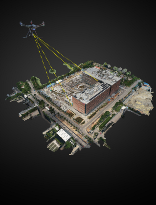
Experience precise digital replicas of your assets created from high-quality drone-captured images. These digital twins can be used for design, analysis, simulations, and more. Accessible through our cloud platform, they are available anytime, anywhere.
Powerful Measuring Capabilities
Measure distances between any two points, calculate areas or volumes, determine the elevation of specific locations, and generate profiles effortlessly. Our platform provides a comprehensive suite of measuring tools, empowering you to extract precise and meaningful data.
Integration with Legacy Systems and Software
Effortlessly integrate with your existing software such as Autodesk Revit, ArcGIS, and more. Export data in compatible formats for a smooth transition.


