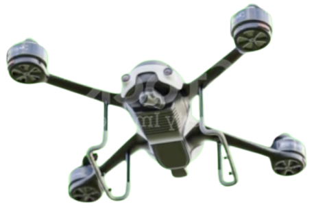
At YelloSKYE, we pride ourselves in powering businesses on Drone Technology and Aerial intelligence. Our Solutions go beyond drone technology. Our UAV’s enable Drone Photography, Reality Capture, Aerial Intelligence, and Image Analytics- we harness the data and insights gathered to facilitate informed decision-making, process optimization, and enhanced performance across multiple sectors including Construction & Real Estate, Industrial & Warehousing, BFSI, Mining, and more, with our comprehensive suite of drone solutions.
Our Solutions
Our Drone as a Service (DaaS) Solution empowers businesses with how they CAPTURE, ANALYZE, AND DISSEMINATE crucial insights to derive outcomes that are actionable and valuable
ASSET RISK MANAGEMENT
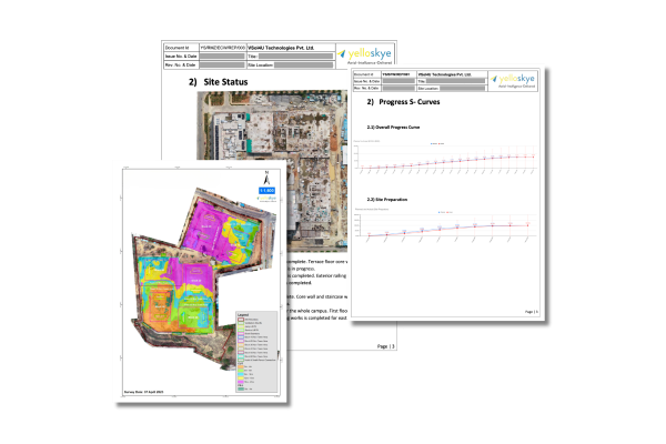
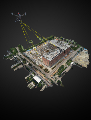
A comprehensive drone aerial mapping solution for visual data inspection, measurement, analysis, and reporting.
The Best-in-class Drone Photography and Drone Video Productions elevates your brand with interactive and immersive media, marketing, and entertainment assets.
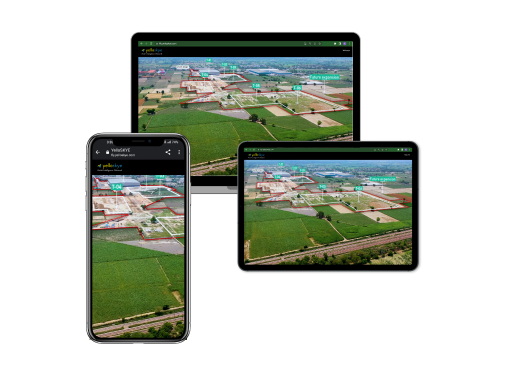
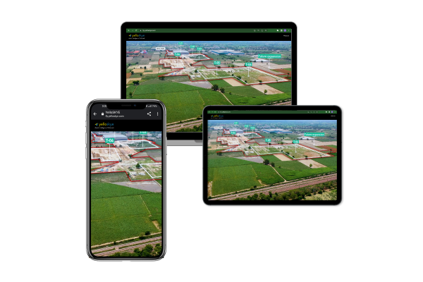
Unlock the potential of precise geospatial data to drive your business decisions. Harness invaluable insights via our interactive platform, empowering you to make informed choices enriched by location-based intelligence
We are an end-to-end player serving a diverse range of industries Pan-India delivering ground truth delivering drone services near you. We focus on finding a solution to your pain point and serve solutions to use cases that are industry-specific in nature. Namely:
Explore how our advanced technology, AI, and machine learning analytics, driving businesses to informed decisions, process efficiency, and peak performance—yielding tangible results for our delighted customers
"YelloSKYE's 3D drone mapping and analytics streamlined exceptional our decision-making process. Their easy-to-integrate turnkey solution and elevated dedicated team our operations. Highly recommended!"
Kiran Kaushik
Director | Some Great Corp
"YelloSKYE's making process. Their easy-to-integrate turnkey solution and dedicated team elevated our operations. Highly recommended!2"
Kiran Kaushik
Director | Some Great Corp
"YelloSKYE's exceptional 3D drone mapping and analytics streamlined our decision-making process. Their easy-to-integrate turnkey solution and dedicated team elevated our operations. Highly recommended!"
Kiran Kaushik
Director | Some Great Corp
"YelloSKYE's exceptional 3D drone mapping and analytics streamlined our decision-making process. Their easy-to-integrate turnkey solution and dedicated team elevated our operations. Highly recommended!"
Kiran Kaushik
Director | Some Great Corp
"YelloSKYE's exceptional 3D drone mapping and analytics streamlined our decision-making process. Their easy-to-integrate turnkey solution and dedicated team elevated our operations. Highly recommended!"
Kiran Kaushik
Director | Some Great Corp
"YelloSKYE's exceptional 3D drone mapping and analytics streamlined our decision-making process. Their easy-to-integrate turnkey solution and dedicated team elevated our operations. Highly recommended!"
Kiran Kaushik
Director | Some Great Corp
"YelloSKYE's exceptional 3D drone mapping and analytics streamlined our decision-making process. Their easy-to-integrate turnkey solution and dedicated team elevated our operations. Highly recommended!"
Kiran Kaushik
Director | Some Great Corp
"YelloSKYE's exceptional 3D drone mapping and analytics streamlined our decision-making process. Their easy-to-integrate turnkey solution and dedicated team elevated our operations. Highly recommended!"
In an era where data is the new gold, geospatial data emerges as a crucial asset for businesses aiming to navigate the competitive landscape with precision and insight. YelloSKYE M
In the ever-evolving realm of real estate marketing, drone technology has emerged as a game-changer. Advanced drone solutions are redefining the landscape, offering an amalgamation
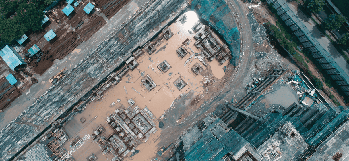
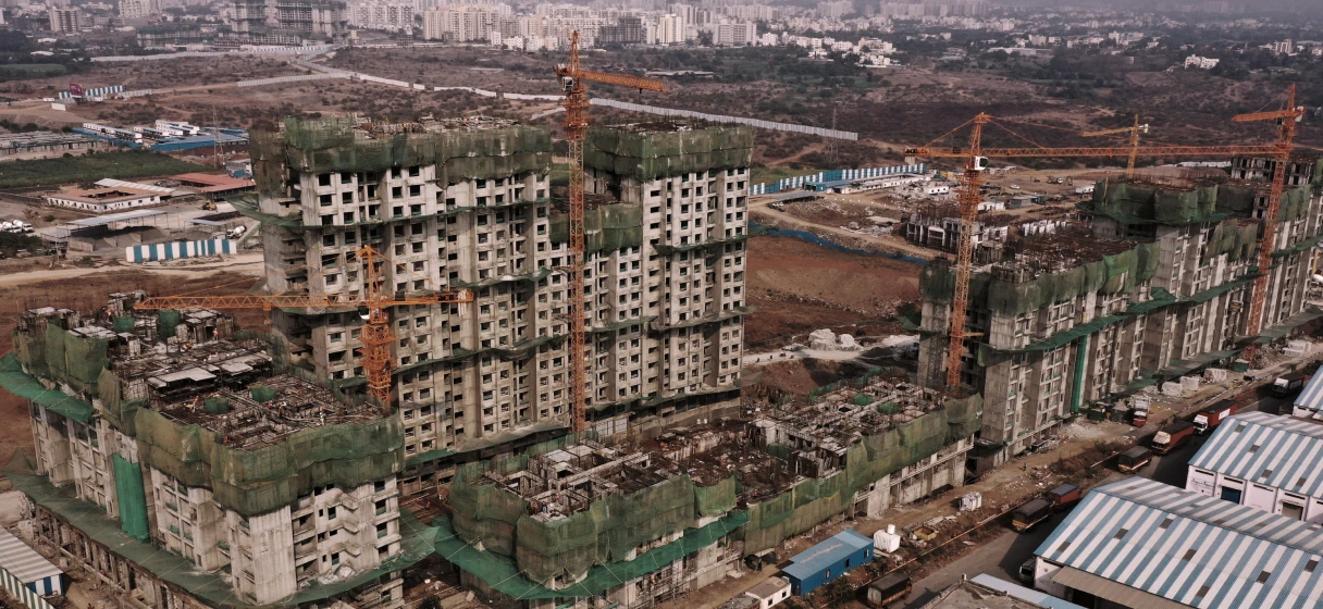
In an era where technology continually reshapes industries, the construction sector stands on the brink of a significant revolution driven by drone technology. Drone solutions, tra
Asset management in industries like construction, infrastructure, and industrial domains is entering a new era with the advent of drone technology. Gone are the days of relying sol
In an age where technology is constantly evolving, drones have emerged as a powerful tool that has revolutionised various industries. One of the most impactful applications of dron
No. We are not a drone manufacturer. In fact, we are a full Drone Solution and Drone as a Service Solution provider who go beyond Drone Technology. We deliver aerial intelligence and provide Drone Inspection as a Service that provides valuable and actionable business insights by collecting site data with our cutting-edge drone technology with advanced reporting capabilities.
2. At which locations does YelloSKYE operate?
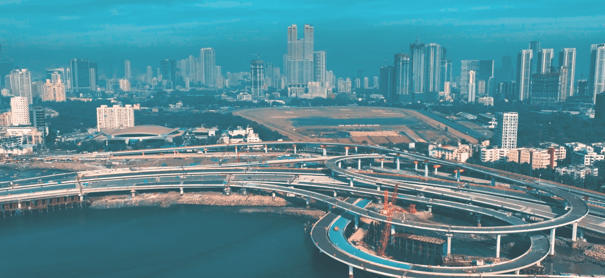
We cover all locations Pan-India and have offices in Pune and Bangalore. This ensures that there is always YelloSKYE drone service near you.We deliver projects across the length and breadth of the Indian subcontinent
3. How accurate and reliable is the data captured by drones?
YelloSKYE is a drone company that is hinged on providing accurate drone data and analytics. Depending on the use case, drone data is typically more accurate than traditional methods - for E.g. in Land survey and inspections. For more specific accuracy details, please feel free to reach out to us.
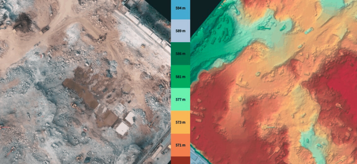
To give perspective, YelloSKYE provides elevation data which is accurate down to ±20 mm. In comparison, Google Maps is typically accurate to ±3000 mm
4. How can I access and visualize the data captured by drones?
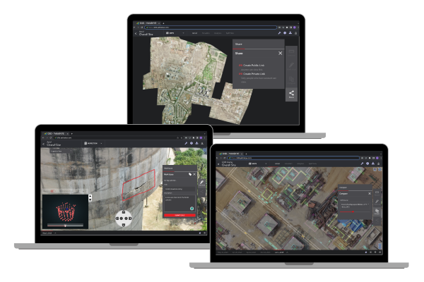
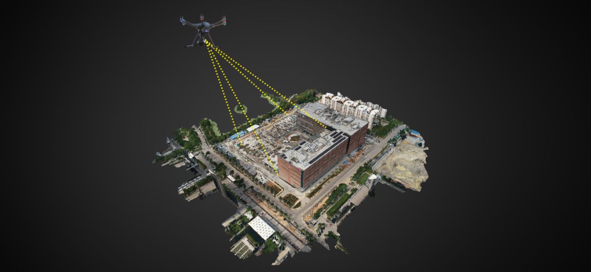
YelloSKYE provides a cloud platform called DEX & D3D,for our customers to have unlimited user access. Our cloud platform works like Asset Management software and seamlessly across devices and operating systems,including mobile and tablet. Our client organizations can leverage our enterprise level access control and can limit access to specific departments within their organization. The platform also allows export of reports to legacy industry standard tools like AutoCAD, ArcGIS, BIM software, etc. that make adoption immediate, and your work as easy and convenient as possible.
5. Is YelloSKYE registered and/or licensed for aerial drone photography?
YelloSKYE is registered as an operator on DGCA’s DigitalSky platform registered operator with licensed pilots and drones having UINs.
6. Do I need to take any approvals or permissions?
YelloSKYE is registered as an operator on a DGCA’s DigitalSky platform registered operator with licensed pilots and drones having UINs.Our customers need not apply for specific or separate approvals. If any exemptions are required, YelloSKYE notifies its customers and takes appropriate measures
7. Does YelloSKYE provide indoor inspection drones?
YelloSKYE can provide indoor inspection drones on a case-to-case basis, depending on the nature and scope of the inspection. Reach out to us with your specific business requirement for us to be able to suggest the best option.
8.What does a drone survey cost at YelloSKYE ?
YelloSKYE drone survey and mapping is typically based on the area of coverage, and the scope of the survey. We are typically priced at par, in some cases, more competitively than standard industry pricing for comparable outputs and quality.
9. What is the cost of your services?
YelloSKYE’s professional drone services are competitively priced based on the outputs and the volumes provided by the client. We have a wide range of customized outputs and reports. We would love to engage with you on a one-to-one basis to understand your business and design a customized package that meets your requirements.
connect with us
Unlock the potential of your projects with YelloSKYE