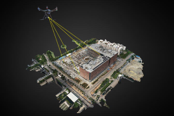

Accurate 2D and 3D Digital Twins
Experience precise digital replicas of your assets created from high-quality drone-captured images. These digital twins can be used for design, analysis, simulations, and more. Accessible through our cloud platform, they are available anytime, anywhere.

Accurate Estimation of Quality & Quantity
Our cutting-edge tools harness the power of AI & Machine Learning to provide unparalleled accuracy in estimating both the quality and quantity of your assets.
CAD Overlay for Plan vs Reality Checks
Compare CAD drawings with actual drone images for accurate assessments. Identify deviations, alignments, and discrepancies to improve decision-making and quality control.
 1")
Regular Drone Captures for Progress Monitoring
Stay informed about asset progress with regular drone captures. Our cloud platform provides timely updates, eliminating the need for frequent site visits and saving travel costs. Collaborative annotations facilitate effective communication and task delegation.

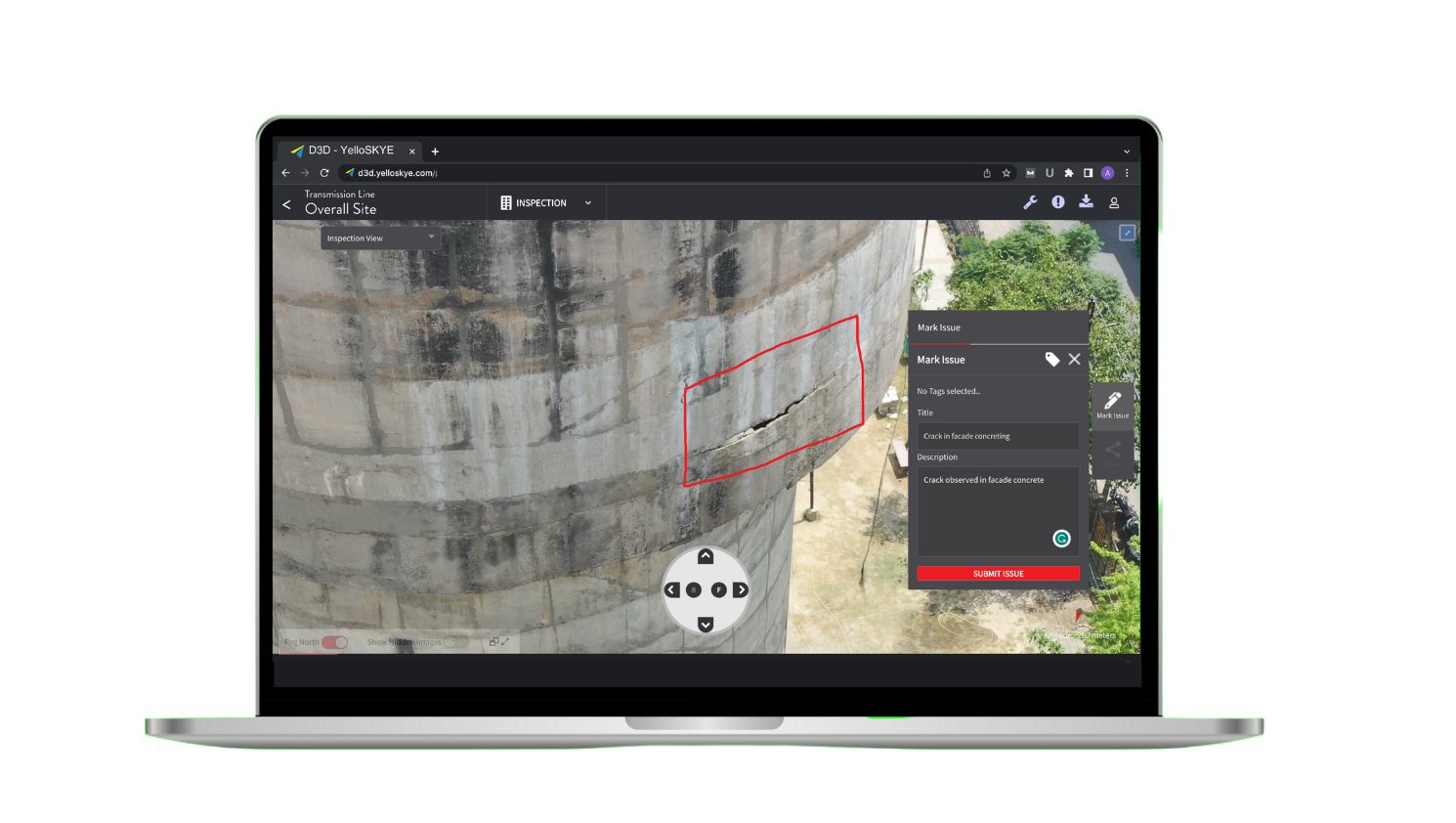
Advanced Inspections of your Assets
Inspect hard-to-reach areas of your assets with drone-captured imagery. Identify faults and issues for prompt action, ensuring asset safety. Access the images anytime, anywhere through our platform.

Interactive Platform with Unlimited Cloud Access
Experience our user-friendly cloud platform with unlimited access. Seamlessly manage your assets from any device, anywhere, and securely store data in the cloud.

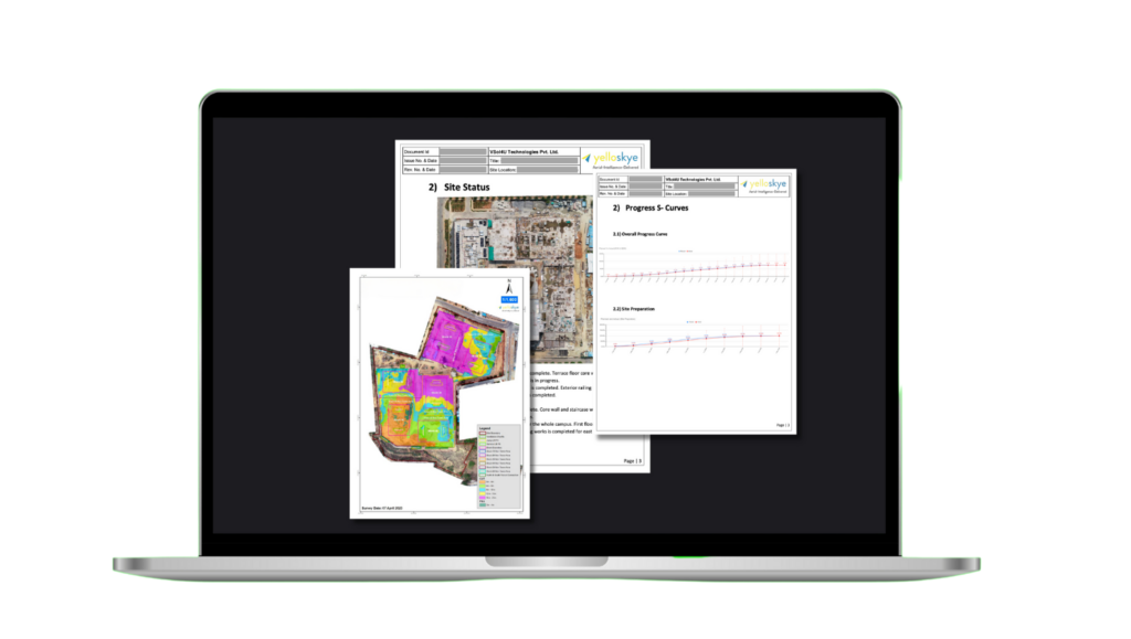
Customized Reports for Critical Decision-making
Our skilled team, combined with our advanced platform, helps you improve efficiency, mitigate risks, and achieve cost and time savings. Choose Asset Risk Management today.

Integration with Legacy Systems and Software
Effortlessly integrate with your existing software such as Autodesk Revit, ArcGIS, and more. Export data in compatible formats for a smooth transition.

BRIDGE INSPECTION
Enhance precision in safety and maintenance. Identify minor and major declines like cracks and repair not visible to the naked eye

DISASTER MANAGEMENT
Use drones for aerial mapping to generate situational awareness and accelerate response time

INDUSTRIAL INSPECTION
Use drones for visual inspection to enable maintenance procedures

MINE SURVEY
Improve overall efficiency of mines and quarry management with accurate aerial data using drones

PIPELINE INSPECTION
Enable timely inspection of pipes condition and take proactive measures to resolve it

POWERLINE MONITORING
Boost grid efficiency with real-time powerline monitoring. Minimize downtime, maximize insights.

RAILWAY SERVICES
Use drones to assess railway infrastructure, redevelopment - from bridges, to roof tops to inaccessible infra

ROAD INSPECTION
Use drones to generate accurate, current topography maps,with elevation & contour lines

SMART CITY SURVEY
Use drones to fastrack smart city planning and redevelopment with drone data and aerial intelligence

SOLAR PLANT INSPECTION
Enhance efficiency by identifying faulty solar panels and repairing them proactively
SMART CITY SURVEY
Use drones to fastrack smart city planning and redevelopment with drone data and aerial intelligence
SOLAR PLANT INSPECTION
Enhance efficiency by identifying faulty solar panels and repairing them proactively